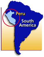
You probably know
that Peru is on the western coast of South America.
It's about three
times the size of California.
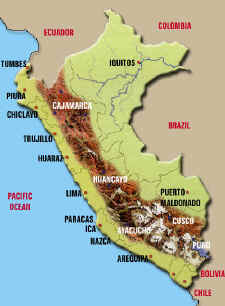
Peru has three
distinct sections: The Coastal Plain on the left of this map below, the
Highlands shown in the brown which includes the northern Andes mountain range,
and the Rain Forest which is all the green to the right of the mountains.
The population of
Peru is nearly 28 million people. The Coastal Plain is 10% of the
land but has 80% of the people. There are over 8 million people in the
city of Lima alone! The Highlands is 30% of the land and has 15% of the
population. That leaves the Rain Forest with 60% of the land and only 5%
of the people. This is wonderful for the nature, but very hard for
those peoples who live there to get any attention from the government.
Ecotourism may finally make the government realize that this huge part of their
country is important.
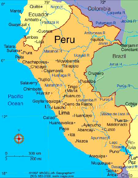
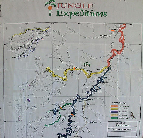
We visited the rain
forest in the northeastern part of the country, beginning our boat trip in the
city of Iquitos--see middle map. We went up the Amazon to the Ucayali, the
Canal, and the Mara˝on rivers. On this map below we went on the red, dark
blue, green and yellow rivers approximately as far as the orange marks. We
also went into many small creeks and tributaries on our daily excursions in
small skiffs away from La Amitista, our main boat. The land between the
yellow and blue rivers is all national preserve.